4 Big Upgrades to Make Getting Around Miami Easier
🚦 Accounting for live traffic conditions
Citymapper now updates your travel and arrival times for Metrobus and Beach Trolleys based on current traffic – and shows you where congestion is, right on the map.
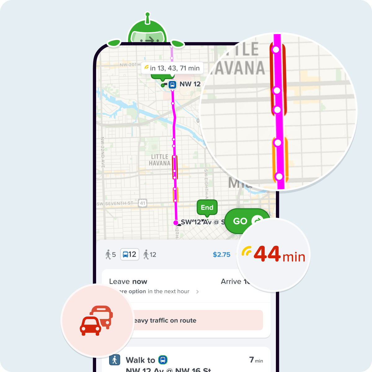
➡️ More info here!
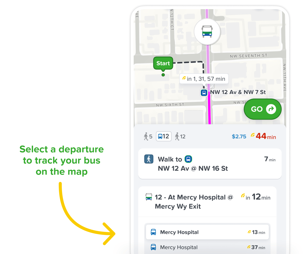
📍 Track your Bus on the Map
You can now track Metrobus and Miami Beach Trolleys (but also Palmtran and Broward buses) live on the map – making your journey smoother, smarter, and more predictable.
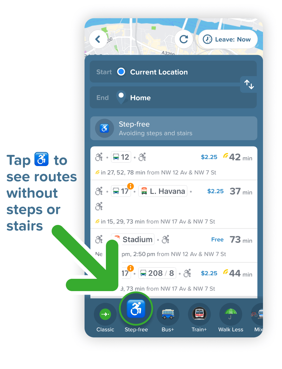
♿️ Step-Free, Wheelchair-Accessible Routing
Need to avoid stairs? Carrying 🧳 luggage or pushing a 👶 stroller? Our routing now highlights wheelchair-friendly, step-free journeys, using only stations with elevators and ramps.
🚏 Improved Bus Stop Locations
Nearly 500 bus stops have been updated to match their real-life locations. That means:
- Better walking directions
- More accurate transfer times
🤓 Most Accurate App in Miami
Delays, diversions, live vehicle tracking, real-time traffic, the best carriage to board, even which exit to take at the station – we've got it all covered.
🚀 And We're Not Done Yet...
We’re always improving.
Got feedback or suggestions? Write to us✍️
💚 Team Citymapper 💚
